 In point of fact, I did rather well. Considering I entered California just as the peak of the pandemic was coming to bear, things could have been much worse. Fortunately my agenda was to explore the various and sundry natural delights the State has to offer. Had I been pitched on exploring its urban delights I’d have been cancelled in a heartbeat. But pandemic or no the redwoods still hold forth in their damp purlieus and the citrus groves soldier on producing flower and fruit no matter how many of us succumb to the coronavirus. The precincts of the natural world are perfectly safe — an important point to remember. It’s people who are poisonous in the pandemic equation. No people, no virus — odd how that works. So my intent to focus on tree, flower and shore kept me as much out of harm’s way as anything could do.
The problem, of course, is access to those natural delights. I lucked out on the coast with the redwoods. The visitor centers in the parks were closed but the roads were not chained shut so full access to the parks remained available, as is evident from the riot of images in my previous post. But life must go on and that meant heading toward the Central Valley. Stop Number Two was the sequoias. So when my days in Arcata ended I set out to wend my way back across the State to the western flanks of the Sierras.
To accomplish that trajectory I decided to use Highway 36 running from Fortuna/Alton (a bit south of Eureka) over to Red Bluff where I planned to cool my heels for a day. The rain started the night before I left and went in fits and starts all day, but there was enough clear weather in the interstices to put an occasional glow on the landscape. And boy, what a landscape. But there’s a hitch. If you’re a solo traveler as I am, you do all the driving. Highway 36 is not so easy a drive as Highway 299 coming from Redding. It’s up hill and down dale and I doubt there’s a straight mile of it anywhere between Alton and Red Bluff. If you happen to be in the passenger’s seat and you trust the person behind the wheel, then you’re in for a treat: the landscape is stunning.
If, however, you are yourself the one behind the wheel then you’ll find that you need to devote all your attention to your job as driver without gawking at the landscape lest you miss one of the hairpin turns and end up at the bottom of some chasm or other. Consequently I can give only a general impression of the stupendous landscape one passes through on Hwy 36, while my memories of the landscape details I saw driving across Hwy 299 are clear. A great pity, but there it is.
Google Maps will tell you it’s a drive of about three and a half hours from Arcata to Red Bluff via Hwy 36. That’s bollocks, mate. It took me over five hours and I only stopped once for 10 minutes. The speed limit may well be posted as 55 along the way but you’ll be lucky to do an average of 40-45 given the twists in the road and the steep uphills and downhills thrown into the bargain. Then there’s the complete isolation of the route to consider. If you have full confidence in your car, as I do in my Asian Buick, then go for it. If, however, you have the slightest doubt about the fitness of your vehicle then choose another route. After driving along Hwy 36 for about an hour I reached the burg of Dinsmore and failed utterly to discern a town in the spot. There was a building off to one side of the road with a few cars at it and the next thing I saw was a blue sign telling me: “Next Services 98 Miles.” That unsettling information presupposes there are services to be had in Dinsmore — God only knows what or where they may be — and it’s good way back to Hwy 101, so it seems to me the wisdom of the Highway Commission would be far better served by a warning sign at the START of Hwy 36. The truth of the sign at Dinsmore is incontrovertible. There’s absolutely nothing to be had until you finally reach Red Bluff. Let the wise be forewarned and thus forearmed.
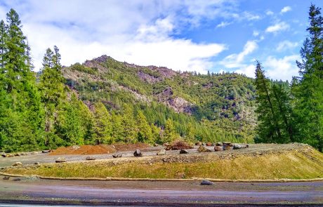
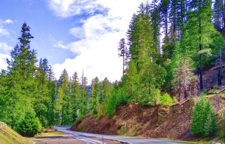
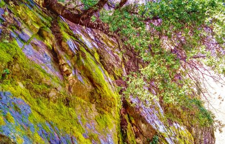
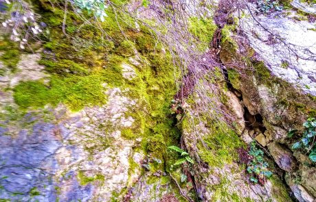
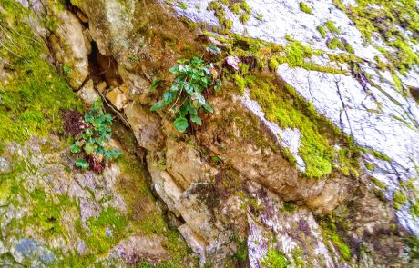
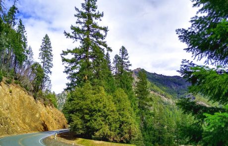
That said, the drive is as scenic as all get out. It goes much higher in elevation than Hwy 299 — twice I found myself above the snow line (even in late March, when one supposes snow under rapid retreat) and twice the occasional rain turned to snow, once so persistently that the trees were blanketed with a couple inches of new white stuff. The road had gravel all over it from frequent dustings during the winter season. Since I was just passing through I took all this in stride and kept moving. The one stop I made was brief so I have only a few pics. Here they are:
Looking at the pics makes me rueful about what I must have missed with my eyes peeled on the curves that popped up one after another without respite. But let us not take a backward glance over roads traveled. We’ll never get anywhere if we adopt that m.o. — so on we go.
Shortly before coming into Red Bluff Hwy 36 goes through a landscape I don’t remember having encountered before. I can only describe it as “lumpy.” It has an enormity of small hills close together, no higher than two cars stacked on top of one another — just high enough to make their tops blind spots in relation to what lies over the crest as you drive along. I pictured to myself a herd of cattle or sheep hidden from view as I cruised up the blind hills, hoping to find nothing but empty road when I reached the top. Fortunately I met with nothing untoward but the experience was unnerving. I was amazed to discover that a landscape can be so annoying. But there was a supreme compensation to my frustration as a driver: flaming, glorious redbud lining the road along a good portion of the way. I saw no redbud over in the coastal area so it was a delight of the first order to find it again just outside Red Bluff. And at long last the highway of many splendors reached Red Bluff and my destination was achieved with me none the worse for the wear.
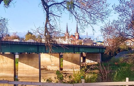
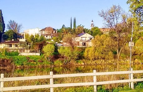
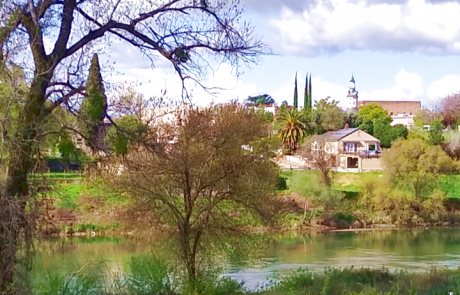
I stayed in Red Bluff only one day with the purpose of doing infrastructure things — e.g. shopping and banking. Although the town has less than 20,000 souls there’s ample opportunity to be a consumer. So I restocked my supplies and prepared myself for the drive down to the southern end of the San Joaquin Valley. The place I stayed had one great advantage among an eminently enumerable list of disadvantages (which I’ll spare you): it was beside the Sacramento River with good views over the river and the old town. Here are the pics:
The afternoon I arrived in Red Bluff it was pissing down rain. Checking into the hotel ended up in a thorough soaking, but I maintained my equanimity of temper and didn’t hold it against the place. It rained again the night before I left and when I went out to the car the next morning I discovered it had frozen during the night after the rain stopped. Thus it was that I found myself scraping windows in sunny California. At that point I said to myself, “I am effing OUTTA HERE.” I didn’t drive south to scrape ice from the windshield, you may rest assured on that point. So I fired up the Asian Buick, turned on the defrosters front and rear, parked in the sunshine for a bit until the sun worked its magic on the side windows, then promptly got on I-5 heading south, hit cruising speed and vowed not to stop until I reached a place where citrus grows. And that’s exactly what I did.
Because of the routes I chose through California the overwhelming impression I have of it is emptiness. From Red Bluff to Porterville, my next destination, there are two ways to go. One is to follow CA Highway 99 that goes through all the burgs along the way, the other is to stay on I-5 and bypass nearly everything south of Sacramento. Since there was no need to stop for gas I decided to take the empty route. And oh boy, is it empty. Driving through the landscape south of Stockton is like being in the wilds of Montana or Wyoming. The trees disappear and there’s just wide open country. If you showed me a photo of it I’d never in a million years guess it’s in California. I became a bit wistful about the disappearance of the trees as I dashed along I-5, but hey, you gotta work with what you have. I’ve been through Montana and Wyoming enough times to know that when the trees go bye-bye you focus on contour. Landscape as sculpture, that’s the ticket. It’s an adjustment that costs me conscious effort, that much I will own, but the dint of necessity was strong and I accomplished the change with minimal fuss and bother. If I found myself feeling disappointed by the emptiness I reminded myself that it could be worse: I could be driving through the cities of the valley, about which I had read reports that made my hair stand on end. Fresno the meth capital of the USA? Sounds like the perfect place to give a miss, doesn’t it?
Finally the turning for the highway to Visalia appeared so off I went heading east. Things improved quickly after I left I-5 — the agricultural splendor of the San Joaquin Valley quickly came into view. Fields of various crops marshalled themselves on either side of me and reminded me that yes, indeed, this place is where a good deal of our fruit and veg comes from. As far as the landscape goes I’m reminded of a rather cutting phrase from an essay by Rebecca West where she describes an outer eastern London suburb (in the direction of Essex, that benighted province) as “a vast dullness.” Things in the nether portions of the San Joaquin Valley are indeed flat with a capital F. I suppose overindulgence in the sight of it might lead one to describe it as dull, but for me the sight of all the things growing kept my interest lively. I thought of the enormous amount of work involved in producing all the things the Central Valley grows. There were signs posted in several fields telling me “Dam Water Grows Food” — a reminder that all is not well in Gotham with regard to water supply. We never think about such things in my neck of the woods. It would never occur to us to divert a river 100% to grow lettuce to feed the nation. The billboards I saw about dam water recalled to mind all the things I’d read over the years about the enormous demand for water that California’s agriculture brings with it and the growing difficulty of meeting that demand. I doubt I’ll be able to pick up a head of lettuce in the supermarket now without thinking of those billboards. That’s probably a good thing, since it does well to remember where our food comes from and how it’s produced. After all, bags of salad don’t just appear magically in the supermarket cooler, do they.
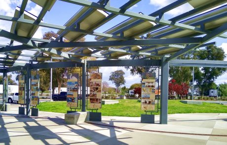
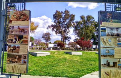
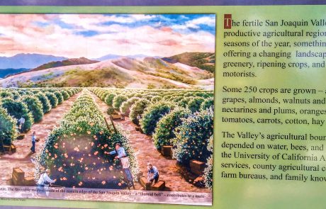
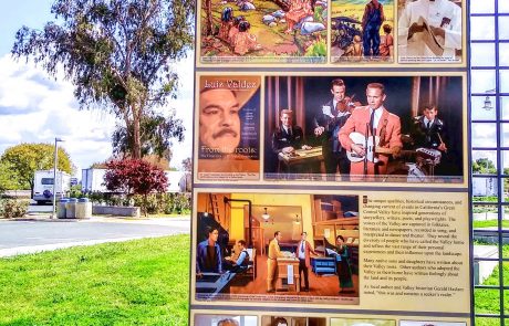
The remainder of the way from the turning off I-5 to Porterville took me for a short stretch down Highway 99. I wasn’t expecting any rest areas on 99 but lo and behold there are some — it’s obviously a proper freeway, a fact about which my ignorance was complete — so in I pulled when I came across the Phillip S. Raine Rest Area between Tulare and Tipton. Truth be told it looked a bit ho-hum from a distance but once out of the car my eyebrows shot up in astonishment. The place qualifies as a Rest Area on Steroids. It’s like a full-on open-air museum. Here are the pics:
I went around reading all the info panels with my astonishment growing at the amount of care taken with developing the content and designing its presentation. So here’s a huge shout out for the Phillip S. Raine Rest Area, which surely knows few peers among its kind. Good on ya, Highway Commission. Keep up the good work.
The chief delight of the short trip from the turning for Porterville off Highway 99 into the town itself was the sight of citrus groves — oranges, to be precise — full of fruit on the trees. Finally I know what it looks like before the fruit ends up in the processing plant and the juice ends up in the bottles that appear in my local supermarket, for billboards announced proudly for all the world to see that these groves produce fruit for Sunkist. I wanted to stop and just gawk at the trees, go up close and see if they had both flowers and fruit on them, as I’ve read citrus is wont to do, but I thought it better to keep moving since the trees are not a tourist attraction and if I were a producer for Sunkist the last thing I’d want is people stopping to have a stomp in my citrus grove. So I appreciated from a distance and finally drove into Porterville.
In Porterville my spate of good luck ended with regard to park access. I chose Porterville because it offers easy access to two prongs of the Sequoia National Forest. But California by that point had gone into serious shutdown and all park access had stopped by the time I arrived — not only were the visitor centers shuttered, the park roads were closed, as well. So that put paid to my notion of seeing the other kind of big trees California is blessed to contain within its borders. But during these past few years as a (global) nomad I’ve had two primary watchwords: “patience” and “flexibility.” So I set about reconfiguring the few days of my visit to the area. I was comforted one morning by checking the temperature at one of the park visitor centers and finding it to be 37 degrees Fahrenheit at 11:00 AM. That’s five degrees above freezing, just to put a fine point on it. Brrrrrr. I thought I’d escape the chills by being far enough south at the end of March but my calculations were off a bit. I’d just driven many hundred of miles to escape the frigidities of the Bitter North; it was a bit disheartening to find the big trees still near the freezing point at mid-day. So I lumped all things together — season, temperatures and pandemic — and decided I’d cut my losses and do whatever came easiest for the few days I spent in Porterville and its environs.
One of those easy things suggested itself when I went to the supermarket and found oranges on sale for $.95 for a 4-lb. bag. As soon as I saw the price I thought, these can only be from the local area. Trust me, in my neck of the woods I have never, NEVER seen a 4-lb. bag of oranges for under a dollar. Inspection of the label on the net bag revealed that, sure enough, they came from Exeter, CA — a mere 17 miles up the road from Porterville. On the spot I resolved to stock up on oranges — 8 lbs. for under $2.00, I still shake my head in amazement — and to drive the following day to Exeter to see what’s up there.
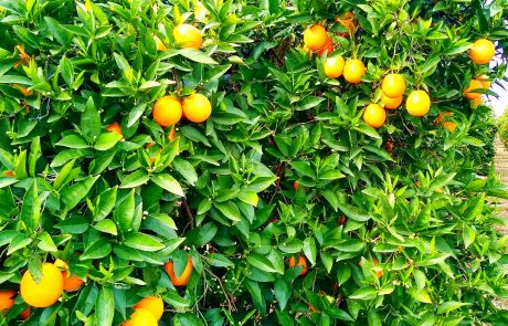
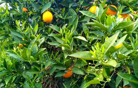
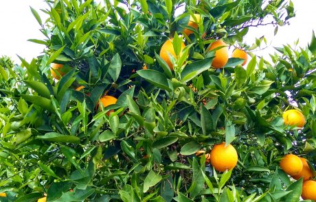
Well, what’s up is CITRUS. Miles of it in every direction. I also saw almonds, olives, grapes (for raisins, I’m sure, not the wine kind) and a few other things I couldn’t readily identify because neither the flowers nor the leaves had yet popped out. I had seen citrus trees in both the Philippines and in Colombia, but not acres of oranges standing there with trees positively groaning under their burden of fruit. So for the first — though hopefully not the last — time in my life I stood in the place from whence the oranges came that I ate that morning for breakfast. Miracle of miracles. I’ve always loved citrus trees and getting up close and personal with some of the orange trees along Hwy 65 just south of Exeter cemented the BFF relationship for eternity. Although the day was dingy (overcast, with a haze that prevented clearly seeing anything more than a quarter mile distant) the orange trees were resplendent. Here are the pics:
If I could have had my druthers I’d have popped back into Porterville to get a patio chair at Home Depot, returned to the orange trees and spent the day just hanging out with them. They are the cheeriest of company. I could feel my state of mind improve just in the few minutes I spent enjoying the sight of their foliage, bud and fruit. They operate on the spirit in the same way the fragrance of orange zest operates on the olfactory nerves: they give a lift. How wonderful. So at the end of the day I felt myself amply compensated for missing the big trees in Sequoia National Park. I had the experience of much smaller but no less wonderful trees for which to be grateful, and grateful I shall remain now whenever I pick up oranges in the supermarket because the memory of the trees in Exeter will come to mind.
Some General Thoughts on California
Since this was my first trip through California I’ve been looking at things in the Big Picture to see if I can arrive at any impressions that capture the reality of the place effectively apart from the hype and the stereotypes. Using my direct experience as the baseline I realize that a couple awarenesses remained persistent as I moved through the areas I visited.
The strongest of these awarenesses concerns poverty. We outsiders who know CA only from the news and from TV think of it as a posh place for the most part. On the screen we see Beverly Hills and its housewives or the Kardashians holding forth magnificently (?) in Calabasas. But the parts of California I saw are not posh — far from it. There’s nothing in places like Arcata or Porterville to urge comparison with Beverly Hills or Calabasas. Arcata is more an extension of down-and-out southern Oregon than it is a northerly relative of San Francisco’s wealthier purlieus. When I drove from Redding to Arcata I stopped in Weaverville along Hwy 299 to get some fruit at the local supermarket. I got panhandled twice in the parking lot, once on the way in and once when I came out. It’s the last thing I expected in a small town in the middle of nowhere in the mountains of northern California — it never happens in my neck of the woods, in the middle of nowhere in the mountains of a different state. Going around the coast near Arcata took me twice through Eureka, where I didn’t stop because of what I had read about the place. It counts as one of the 10 most dangerous cities in California (info here). With a population of less than 30,000 one wonders how it manages to achieve that status being up against places like Oakland or San Bernardino. I didn’t get out of the car to explore the contributing sociological factors. One look at the place makes it clear that it’s as dodgy as the day is long. Arcata also looks decidedly hard-scrabble and I got panhandled a few times when I went out of the hotel for a short walk. Red Bluff, where I stayed one day on my way to the southern Sierras, figures on the same red flag list as Eureka, occupying Slot Number 4. The cities of the San Joaquin Valley are in CA’s agricultural heartland so I thought in my innocence they’d be like Iowa — full of contented cows and happy laddies and lasses with rosy cheeks and big smiles. Not a bit of it. It’s Meth Central, so go the reports. Fresno has a huge problem with meth trafficking and meth addiction among its (large) homeless population. Even the cows are nervous, apparently. Yikes.
Down in Porterville, an hour north of Bakersfield, things are less tense but still hard-scrabble. As I drove around the town (population just under 60,000) I saw pockets of modern commercialism dotted around an older town distinctly frayed at the edges. The streets made me think that there’s no budget for resurfacing. But it’s quiet and doesn’t feel dangerous due to dodgy characters floating about the streets. The only place I’ve seen that gives the impression of being fairly upmarket and upbeat is Visalia, some 30 miles north of Porterville, with a population of just over 150,000. But the day I drove up to have a look-see it smelled like manure even in the downtown shopping area near the main mall. I don’t know if that’s due to the way the wind was blowing or because there are dairy farms just behind Macy’s, but there it is. I didn’t need to see Holsteins cropping grass contentedly to know that they were about somewhere nearby.
My purpose as I passed through California was to see the physical territory of the State. It’s a part of the Planet I didn’t know at all and I wanted to get acquainted. In that regard my time there was a great success. It’s a beautiful place. As I drove through it the reason people settled it so densely became quite clear: it offers fantastic natural environments. Mountains, forests, lakes, fertile soil, good climate — all the things that make settlers jump on the pioneer bandwagon. Since my focus was on those elements rather than on, say, the dodgy neighborhoods of Oakland, I came away with a general impression of California skewed toward the scenic and away from the sociological. It’s clear that things are not well in Gotham as far as current sociology goes. But the redwoods are still OK and the mountains of northern California continue undiminished in their beauty. The Sierra Nevadas are glorious no matter how much meth changes hands in Fresno or Stockton. Climate change has now made major inroads into the State as we saw during last year’s fire season and I drove through several areas where burns had taken place. It’s a grim reminder that people are at the root of more systemic problems than just virus pandemics.
But I tick the box “mission accomplished” for my travel through California. I saw lovely stuff and relished the sight of it. California has fantastic landscapes and remains the only place in the world where you can see redwoods and sequoias. Despite the sociological disorder and the coronavirus pandemic I found it relatively easy and massively rewarding to visit and enjoy those natural features of the State (that unfortunately also gave us the Kardashians, but I’m not bitter 🙂 ). It matters little to me if my impressions of the place are skewed because they’re skewed in the right direction: toward the natural world. Now when I think of California what comes to mind is redbud blazing its glorious color along Hwy 36, the redwoods of Prairie Creek State Park jutting up into the sky and leaving me gobsmacked and a host of other visual impressions that I’ll be more than happy to carry to my grave. “Take the best and leave the rest” so goes the saying. It’s a piece of advice I’m quite happy to follow.

