May 2020
 Since all state parks in North Carolina are closed at present due to the pandemic my go-to has been county parks, which remain open. It’s been a blessing, believe me. After spending some time in Winston-Salem I moved a tad south to Lexington, NC, the county seat of Davidson County. Poring over the map revealed two excellent prospects: Boone’s Cave Park and Eagle Point Nature Preserve down near High Rock Lake. The Preserve is technically in Rowan County, but only just, so I’ll lump it in with Davidson County. It’s the neighborly thing to do, right? 🙂
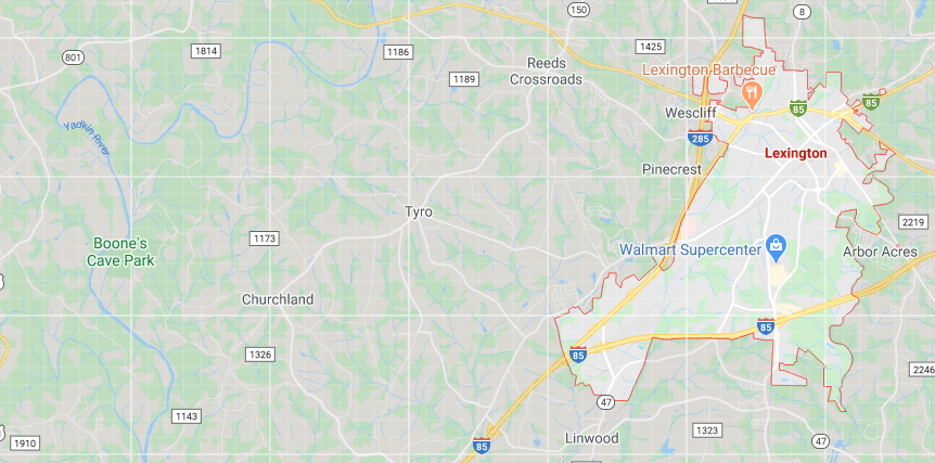
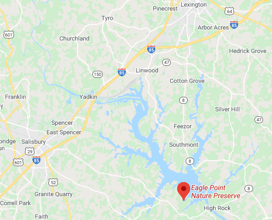
First some maps so you have an idea where things are:
Both places are easy drives from Lexington on very pleasant backroads. As I drove back from Boone’s Cave Park I realized that the landscape is thoroughly domesticated. A lot of land has been cleared — to what purpose remains unclear since there are no herds of contented cows grazing or fields of grain waving in the breeze. After thinking about it I realized that Lexington exists in an urban corridor extending from Winston-Salem/Greensboro all the way down to Charlotte. It would be perfectly doable to live in Lexington and work in Winston-Salem or even Charlotte, since interstates are a dime a dozen in the region. That awareness operated in retrospect on my wander through Boone’s Cave Park, a natural area that remains as the Planet shaped it without any human intervention. On the drive down to Eagle Point Nature Preserve the invasive hand of man is everywhere to be seen because it’s lake country and we all know what humans do with lakefront property. There was a special irony evident in that regard at the Preserve which I’ll point out later. Let’s start with Boone’s Cave Park and see what’s up. It’s a wonderful place and I had a great time paying it a visit.
The Boone in question is Daniel Boone. It never occurred to me that he was name of the game until I saw the commemorative plaque at the main entrance:
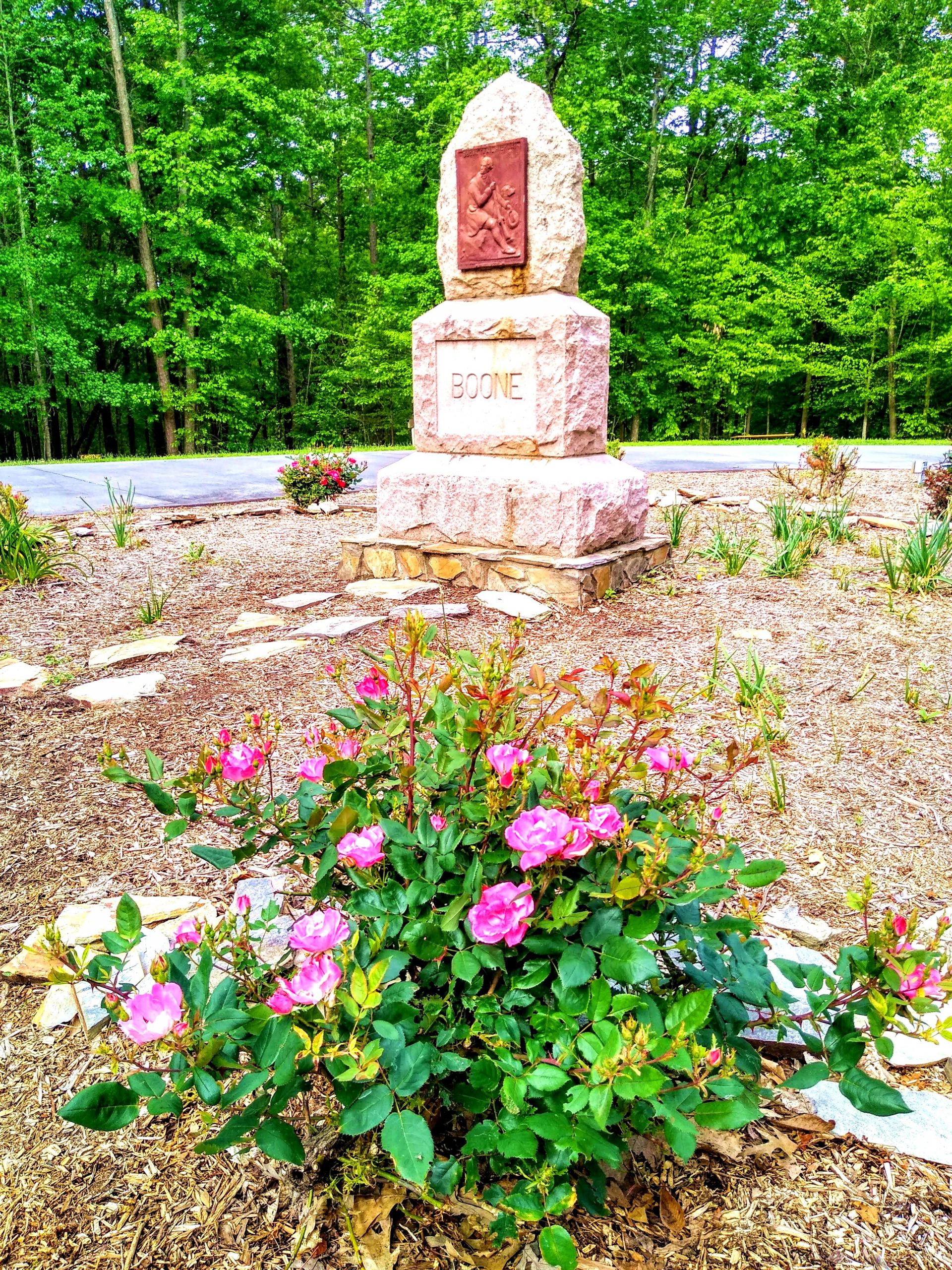
I’ll admit it: I got him mixed up with Davy Crockett. Oops. If you’ve read about one mythic pioneer etc. etc. Anyhoo, subsequent research made clear who he was and what he did. The mythology about him doesn’t match the reality very well, I must say. In this day and age his credit rating would be in the toilet. But hey, he’s an icon, so I don’t want to trash talk him. If the particulars interest you his Wikipedia page is here. Boone’s connection with the park is tenuous at best but I’m perfectly willing to doff my hat to the guiding mythology of the place that gives it his name. After seeing the cave — a rather diminutive thing that would find me ducking into it only to shelter from a tornado — I quickly moved on to my real agenda: the forest.
I want to give a shoutout to Davidson County Parks and Recreation for a bang-up job with the park. It’s fantastic. Just look at the pics of the picnic shelter and the wooden stairway leading from it down to the riverbank:


The river that’s the cause célèbre in this case is the Yadkin. Southern rivers of larger size are not swift-flowing things with rocky bottoms and salmon fighting their way upstream. Their color is about the same as that of a mud puddle after a heavy rain. That’s fine with me since I’m not a water baby and all I do is look. Kudos should go to the Yadkin for being the source of so many of the major lakes of the Piedmont area — including High Rock Lake. It still flows when given a chance, which is the case in the area of Boone’s Cave Park. I didn’t spend a long time contemplating it because I was anxious to get on the trails through the forest, but I did get these two pics:


From the riverbank the path called the “Wildflower Trail” leads back up the hill you descended via the wooden stairway. I had a frisson of excitement shiver through me as I set out wondering what beauties I’d come across on the way. As it happened, there were only a few things in bloom and one of the botanical markers I passed was incorrect. It identified Canadian wild ginger (Asarum canadense) as the plant known in the South as “little brown jug” (Hexastylis arifolia). Canadian wild ginger is also native to my neck of the woods so you can’t fool me on that one. But it’s no biggie, few people look at the botanical markers anyway so we needn’t get all worked up as if Parks and Recreation were telling people to inject themselves with Clorox. 🙂 No harm done, since neither the Canadian nor the Southern version of wild ginger gives a rip what we call them. Besides, both plants are botanically in Aristolochiaceae so it’s all in the family. All good.
The visit to the park was an odyssey in personal development in a way I hadn’t at all foreseen. As I wandered it dawned on me that I needed to learn to see differently with Eastern hardwood forest. The relationship between forest and observer (or admirer, which is truer to the mark) requires a completely different stance from the one I have when I wander the forest I’m familiar with in the Bitter North. The boreal conifer forest I know best has a much wider range of color and texture. The tree species are all different in color, the understorey is much, much denser and full of all kinds of different creatures at different levels. Eastern hardwood forest is nearly monochromatic. It’s beautifully green and beautifully open but its palette is much smaller than what I’m used to seeing in woodlandin the Bitter North. So as I wandered I thought about that difference and about what the hardwood forest needed me to see in order to perceive its beauty fully. Here are some pics from the portion through which I wandered as I wondered:


The need for perceptual adjustment on my part was precipitated by the day being overcast. When the sun is shining the effects of light and shade in this type of forest are themselves like a good half-time show. When there’s a cloud cover then a very different approach is necessary — which isn’t the case with the boreal forest in my neck of the woods. So I walked and pondered until I reached the main entrance again and looked around me in the open. This is what I saw:
It’s a completely different visual field. The trees grow differently in the open and create the feathery overstorey for which the South is justly famous. The variation in color between the tree species — however slight it may be — becomes perceptible and adds to the visual dynamism of the image. The profusion of leaf shapes and textures creates the luxuriance I associate with southern landscape. It’s gorgeous no matter whether the sun shines or not. So I sat and thought about the business for a while before taking my next trail. It occurred to me that what was necessary was attention to detail. The forest is like a book that requires from me the reader a close textual analysis, not just skimming the pages to see if the butler did it. I also reminded myself that the forest is as alive as I am so I needed to pay attention to how it goes about its daily life and to capture in my awareness as many of its aspects as possible.
One of the trails leading off the main parking area is called “Boone’s Peak Trail.” I was amused to read the warning that it’s not suitable “for children or for the elderly.” Since nobody was about I threw caution to the wind and pretended I was still a young thing. As it turned out, what Parks and Recreation thinks is too strenuous for old farts like me is really just a walk in the park. 🙂 Now to the pics from the second half of my perambulations:


Obviously I did something right because every pic in this set carries a specific memory that I feel is reflected in some way — more or less adequately according to the luck of the amateur photographer — and brings a spark of recognition and emotion. I’ll list them for you.
- Pic 1: the two large trees on the right near the top of the ridge stood out as I ascended the path up the hill, their canopies spread out against the sky (which you can’t see very well because they didn’t fit in the image — the eye is better than any camera, I don’t care how fancy it is)
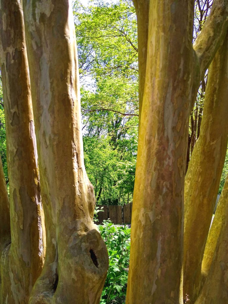
- Pic 2: BEECH! Fagus grandifolia. Commonly called “American beech” but the botanical name means “big-leaved beech” which I find much more to the point. Beech is one of my favorite trees and I came across a stand of them on a hillside. Their trunks are smooth and look like muscle. But that said, they don’t look naked like crape myrtle (Lagerstroemia indica), an ornamental favorite in the South, which in me often provokes the reaction, “OMG dear, cover yourself!!” Here’s a pic:
I can’t explain my special affinity for beech. All I can say is this: if the Lady Galadriel had to pick a primary species for the Forest of Lothlórien from those of the southeastern USA, I know which one it would be. Beech, of course. No other tree would suit the task better. What a delight to see them again in Boone’s Cave Park.
- Pic 3: the contour of the land has its own reality and forms the substrate of the forest experience. I was thinking about what lay under the forest cover — i.e. geology. It matters, you know. Sedimentary? Volcanic? Metamorphic? Time to Google when I get back to the computer …
- Pic 4: Special tree, somehow in the middle of the forest it has become like the trees you see in the open, beautifully broad in form and elegant in its branching. It holds the focus of attention as you move toward it and draws you in.
- Pic 5: The elegance of leaves with a huge number of visual planes all happening at once. Density moves from the understorey — a true understorey in this view — to the dispersion of the canopy. In the sunshine this spot would make you catch your breath, I bet. In the monochrome light of the overcast day it offered me a study in movement and dispersion from earth to air.
- Pic 6: Canopy — but it still leaves the sky visible, so each branch and leaf is etched against the light. I think in the sunshine it would be much harder to see in this way, so the advantages of the cloudy day come to bear on this view.
- Pic 7: Diva tree: umbrella magnolia (Magnolia tripetala). They’re not big but when they show up in the forest they are rock stars. I always think about how ancient the species are, too — the fossil record has magnolia species dating from the Cretaceous Period (dino times). Some things never go out of style. 🙂
- Pic 8: Creekside wildflower cluster: foamflower (Tiarella cordifolia), a plant I know from the Bitter North. Growing beside a small creek running down a gulley in Boone’s Peak. Lovely, delicate thing, and one of the few wildflowers I saw.
- Pic 9: Naked geology. Nothing like an outcrop to make the real star of the show take center stage. It’s all about the geology, babes. As it happens the geology is metamorphic, not surprising when you consider that the Appalachian range is one of the oldest orogenies on the Planet, and we are, after all, in the foothills of the Appalachians. I saw another exposed stone — a schist, I believe — down by the river that contained so much mica it glittered even in the half-light of the cloudy day. Ooh la la.
I also have a lot to learn. There are trees I can’t identify, which my attention to detail pointed out quickly as I wandered. Winged elm? You could pull the wool over my eyes in a heartbeat. So I have work to do to be up to the job of a wander through the forest. If you don’t make the effort to know who you’re visiting then your momma did not raise you right. Trees are people too, after all. Let that point never escape our attention.
What a treat the park was, another instance of county parks being fully the equal of their state and national counterparts. Hats off, ladies and gentlemen. Ya done good.
Taking advantage the following day of what Oregonians would call a “sunbreak” (oh, the dismal stretch of days behind that word …) I headed south to Eagle Point Nature Preserve, just a bit farther south of Lexington than Boone’s Cave Park is west. The difference between the two venues could not be greater. Allow me to explain.
Eagle Point Preserve is at the southern end of High Rock Lake, a reservoir created by damming the Yadkin River. It’s ENORMOUS. I was surprised to discover that access is difficult for so large a lake — there are relatively few public access points. When I drove down past it on my way to the Preserve all became clear. It’s lined with posh houses and looks as bougie as all get out. There are speedboats out and about and “PRIVATE” signs all over the place. From the Wikipedia page comes this news:
Much of High Rock Lake is lined with privately owned homes, representing all income levels. Prior to 2008, Alcoa had required that all new homes have 8 feet (2.4 m) of water when at full pond and have 200 feet (61 m) of lake frontage before a private pier permit is issued. Boat ramps and boathouses are no longer allowed to be built, although existing structures that are maintained are grandfathered. Retaining walls at the high water mark are only allowed in extreme cases, although existing structures can be maintained. Private piers are required to be of a floating style, allowing them to be usable even with lowered water levels. The new 38 year FERC License allows greater flexibility to add roof structures over many existing piers and modifying pier sizes, as well as a few other changes that offer somewhat more flexibility to existing lake front home owners.
It’s amazing how little effort it takes to turn a lake with a surface area of 15,180 acres and 360 miles of shoreline into the equivalent of a housing development with covenants. Just. Shoot. Me.
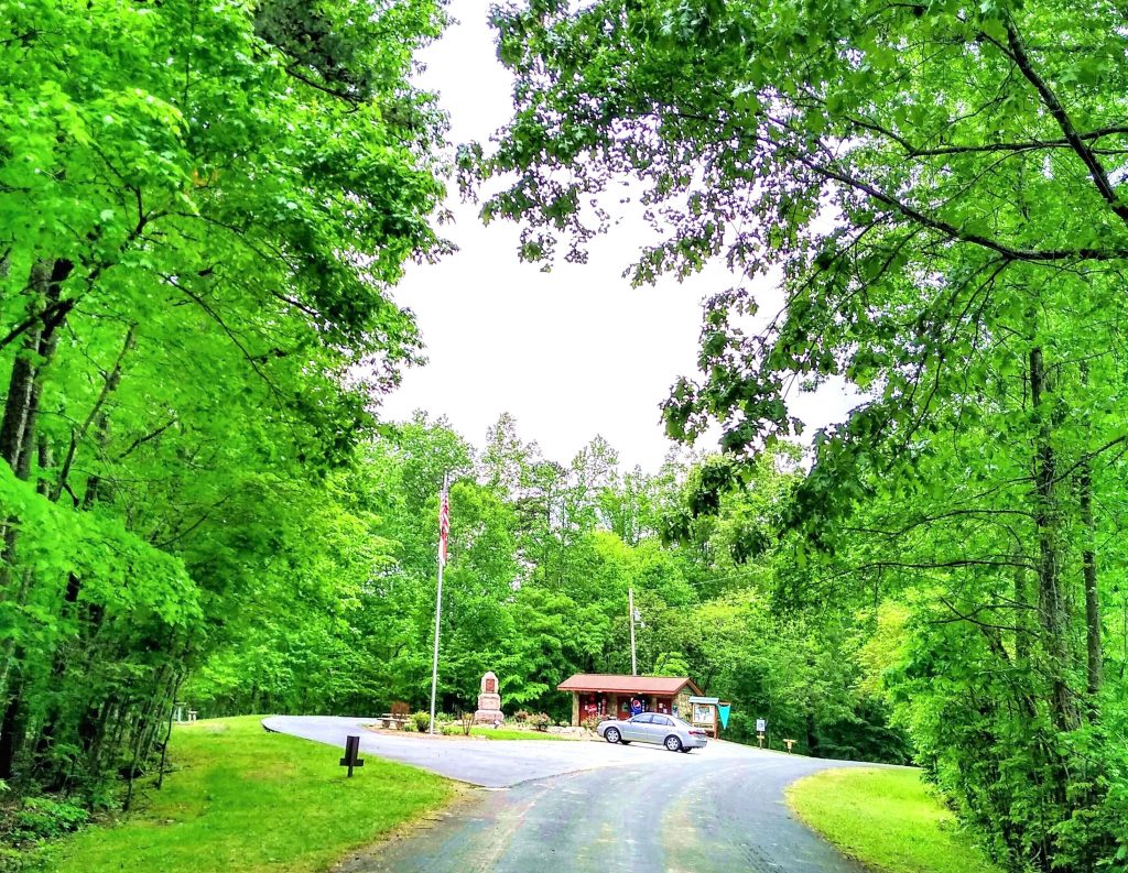
The Preserve is an odd spectacle of a place, I’m sorry to report. It’s managed by Rowan County Parks and Recreation but has the feeling of a mom-and-pop affair run by some doddering uncle of the family who took on the job years ago and stuck with it because he’s fit for nothing else. The paths are full of dips that form pools of water after a rain (as was the case the day of my visit) and the forest itself is a product of the distention of nature that created the lake. In other words, it ain’t natural. It’s a reflex reaction to the change in environment to lacustrine from lowland hardwood forest. The result is the predominance of Virginia pine (Pinus virginiana), also known as Virginia scrub pine or Jersey pine. “Often found on poorer soils” was the news I found when I consulted botanical information. Oops. The forest floor in the Preserve is covered with pine needles, not leaves. That tells the story. Pine needles are acidic buggers and not much will grow around them. That explains the lack of understorey plants. Of the few I saw identified by botanical markers one was poison ivy. Double oops. Here are the pics:


I was hoping I’d come across Track the Beagle so I could point out to his attention that dogs are allowed ONLY ON LEASH, but I never spotted him. Drat. Anyhoo, I took advantage of the opportunity for a brisk walk and enjoyed seeing the poison ivy climbing up the pines knowing that I was maintaining proper social distancing with it. On my way to the Preserve I had noticed adjacent to its entrance what appeared to be a residential area but I thought to myself, “Oh surely not, we’re out in the middle of bleeding nowhere and there are mobile homes just up the road, surely not …” So after leaving the Preserve I parked at the turnoff to its entrance and hoofed it the short distance over to the side street under suspicion. I stood stock still with amazement for a moment when I understood that it’s a bleeding gated community. With a card reader to open the frigging gate. Just. Shoot. Me. Here’s the evidence:


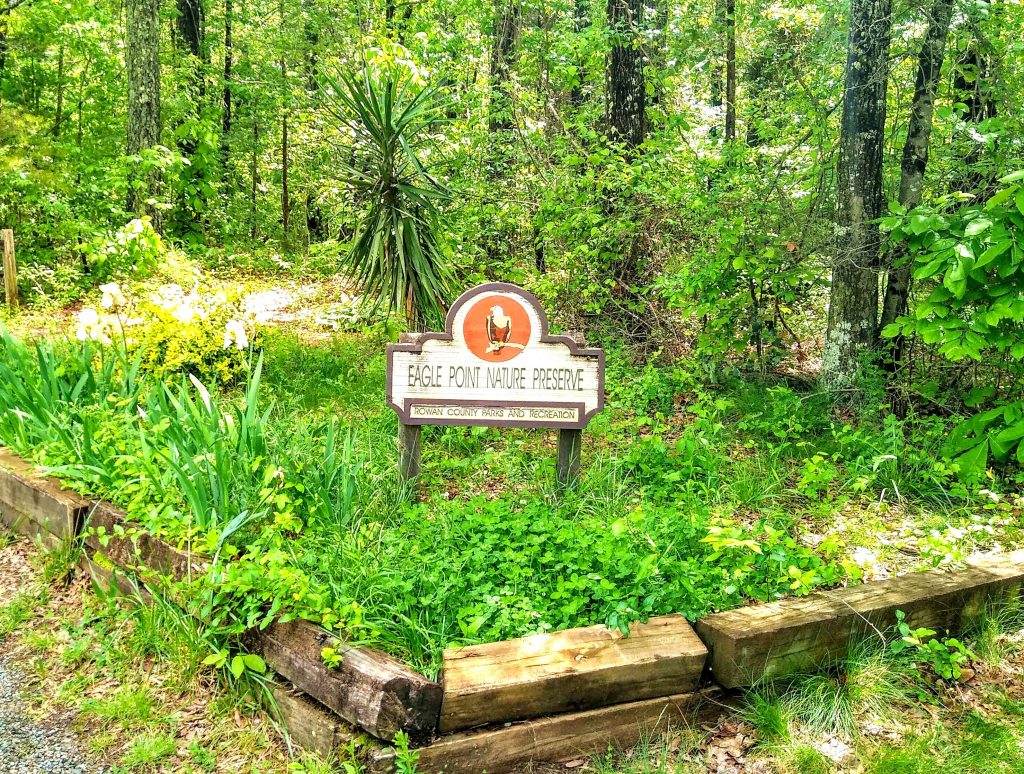
If you stand at the entrance to the development facing the gate and turn around you see something entirely different and ever so much more handsome:


The shrub is wild rose of the Southern variety — Rosa blanda. And a gorgeous specimen of it into the bargain. Who needs lamb’s ears and coreopsis when you have that growing wild on your doorstep? When I walked back to the car I considered for a moment the entrance ensemble for the Preserve and how it compared to the masonry extravaganza of the entrance sign for the gated community. Have a look:
You know, I know, they’d get a nasty memo if they put something like that in the gated community just next door. It’s all about property values, dontcha know. Just. Shoot. Me.
Well, the drive on the backroads of Davidson County is always lovely and I did due diligence by stopping at Flat Swamp Public Access to get a view of the lake. Flat Swamp … sounds very public, doesn’t it, not like “Emerald Bay” with its masonry sign and card-operated gate. There was no card reader at the Flat Swamp Access and there are no covenants, just the usual public park rules and regulations. At Boone’s Cave Park I saw on the sign announcing park rules “No Profanity” (ah, the South …) but I wasn’t in the mood to cuss so I paid it little mind. A lake is a lovely thing even if it’s surrounded by posh housing developments, so let’s have the pics and get ‘er done, hon:


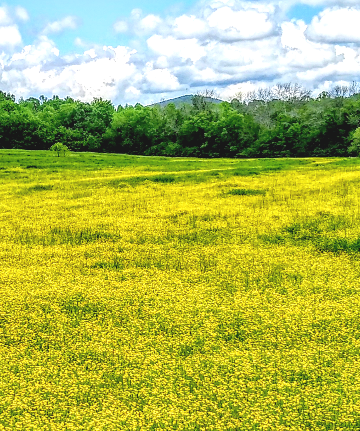
There were tons of photogenic spots on the way back to Lexington that I’d have loved to show you, but it’s a pain to find a place to pull over to take a pic so I just kept driving. I stopped once, at the junction named Healing Springs where Highway 8 meets Bringle’s Ferry Rd. There’s a field there full of buttercups, a sight I’ve seen many times here in North Carolina and I never tire of it, it’s the perfect image of Spring. So on that note I close, with the promise of more loveliness to come as I cross its path in my travels.